Nagorno-Karabakh
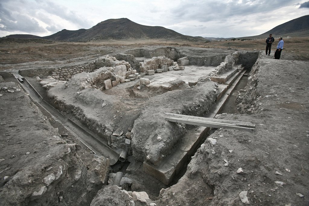
Tigranakert castle-museum near to the city of Tigranakert, built by Armenian King Tigran the Great (Ist century), dating back to the Hellenistic period. According to historians there were 5 major cities built by Tigran the Great at various strategic positions throughout the Armenian Empire. Each of these cities was named after the king - Tigranakert. This one, named Tigranakert of Artsakh, occupies an area of about 50 hectares and is located in the province of Martakert in the Nagorno-Karabakh, four kilometers South of the Khachenaget River. Excavations at Tigranakert began in March 2005, when it was first discovered, and are currently ongoing. Aghdam region, Nagorno-Karabakh, 19 September 2008.
Nagorno-Karabakh
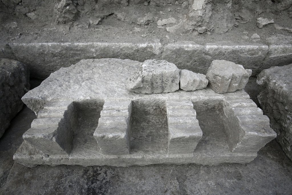
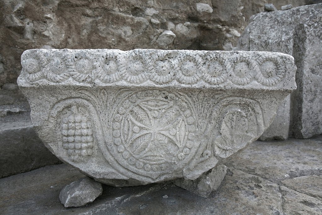
Armenian ornaments discovered in the church ruins (Vth-VIIth centuries) near the city of Tigranakert, built by Armenian King Tigran the Great (Ist century), dating back to the Hellenistic period. According to historians there were 5 major cities built by Tigran the Great at various strategic positions throughout the Armenian Empire. Each of these cities was named after the king - Tigranakert. This one, named Tigranakert of Artsakh, occupies an area of about 50 hectares and is located in the province of Martakert in the Nagorno-Karabakh, four kilometers South of the Khachenaget River. Excavations at Tigranakert began in March 2005, when it was first discovered, and are currently ongoing. Aghdam region, Nagorno-Karabakh, 19 September 2008.
Nagorno-Karabakh
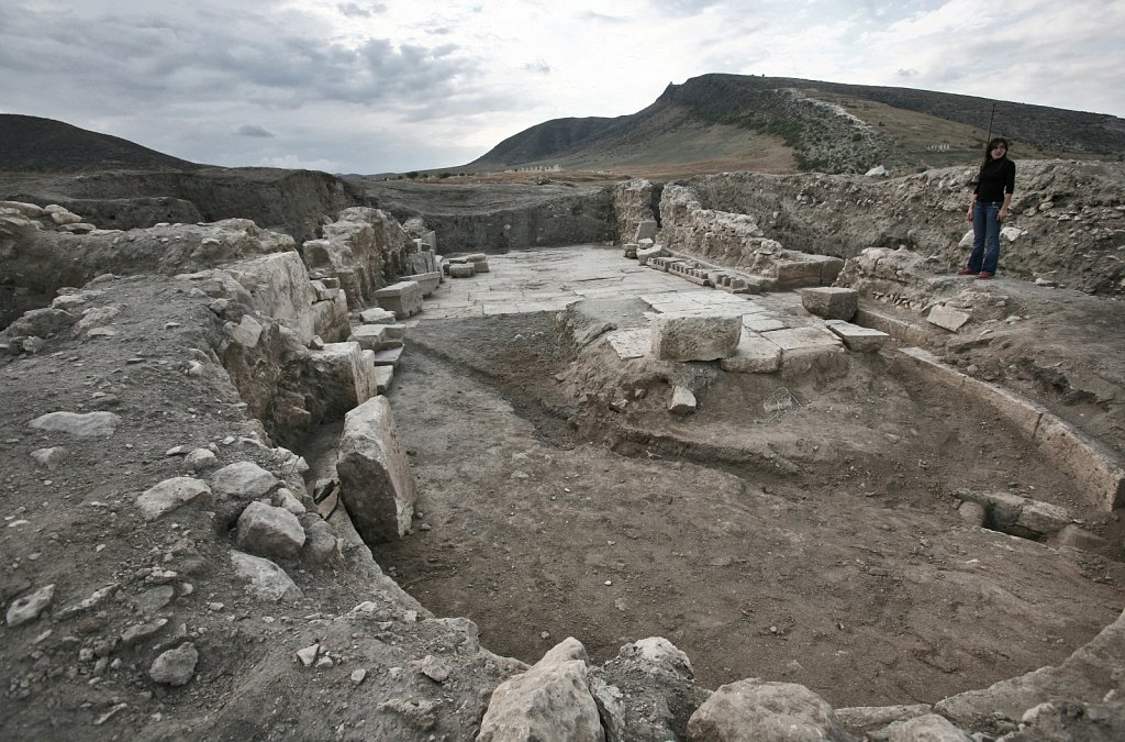
Ancient church ruins (Vth-VIIth centuries) near the city of Tigranakert, built by Armenian King Tigran the Great (Ist century), dating back to the Hellenistic period. According to historians there were 5 major cities built by Tigran the Great at various strategic positions throughout the Armenian Empire. Each of these cities was named after the king - Tigranakert. This one, named Tigranakert of Artsakh, occupies an area of about 50 hectares and is located in the province of Martakert in the Nagorno-Karabakh, four kilometers South of the Khachenaget River. Excavations at Tigranakert began in March 2005, when it was first discovered, and are currently ongoing. Aghdam region, Nagorno-Karabakh, 19 September 2008.
Nagorno-Karabakh
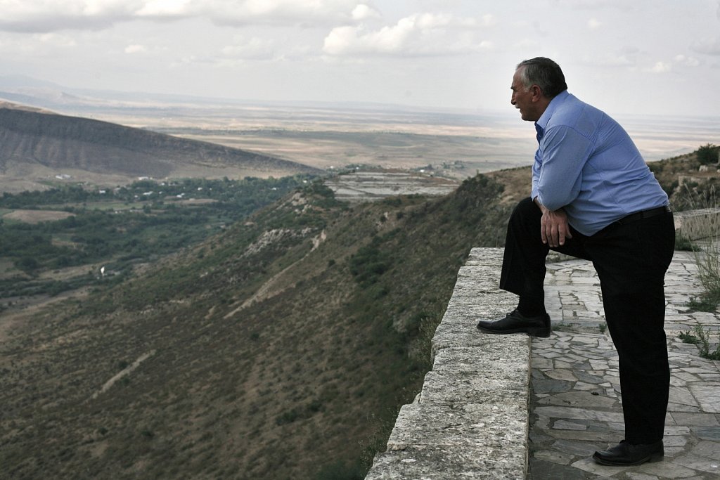
A man watches the ruins of the ancient city of Tigranakert from the plateau of the Vanqasar church. According to historians there were 5 major cities built by Tigran the Great at various strategic positions throughout the Armenian Empire. Each of these cities was named after the king - Tigranakert. This one, named Tigranakert of Artsakh, occupies an area of about 50 hectares and is located in the province of Martakert in the Nagorno-Karabakh, four kilometers South of the Khachenaget River. Excavations at Tigranakert began in March 2005, when it was first discovered, and are currently ongoing. Aghdam region, Nagorno-Karabakh, 19 September 2008.
Nagorno-Karabakh
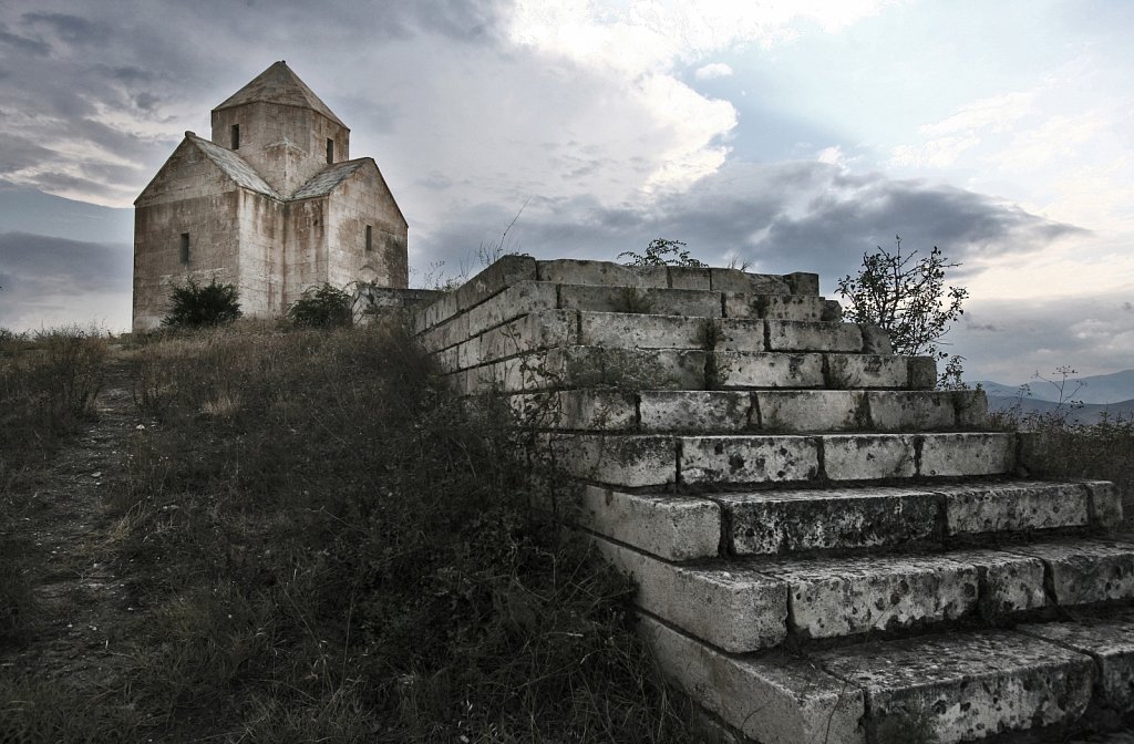
The Church of Vanqasar is an VIIth century Armenian church near Tigranakert of Artsakh. According to historians there were 5 major cities built by Tigran the Great at various strategic positions throughout the Armenian Empire. Each of these cities was named after the king - Tigranakert. This one, named Tigranakert of Artsakh, occupies an area of about 50 hectares and is located in the province of Martakert in the Nagorno-Karabakh, four kilometers South of the Khachenaget River. Excavations at Tigranakert began in March 2005, when it was first discovered, and are currently ongoing. Aghdam region, Nagorno-Karabakh, 19 September 2008.
Nagorno-Karabakh
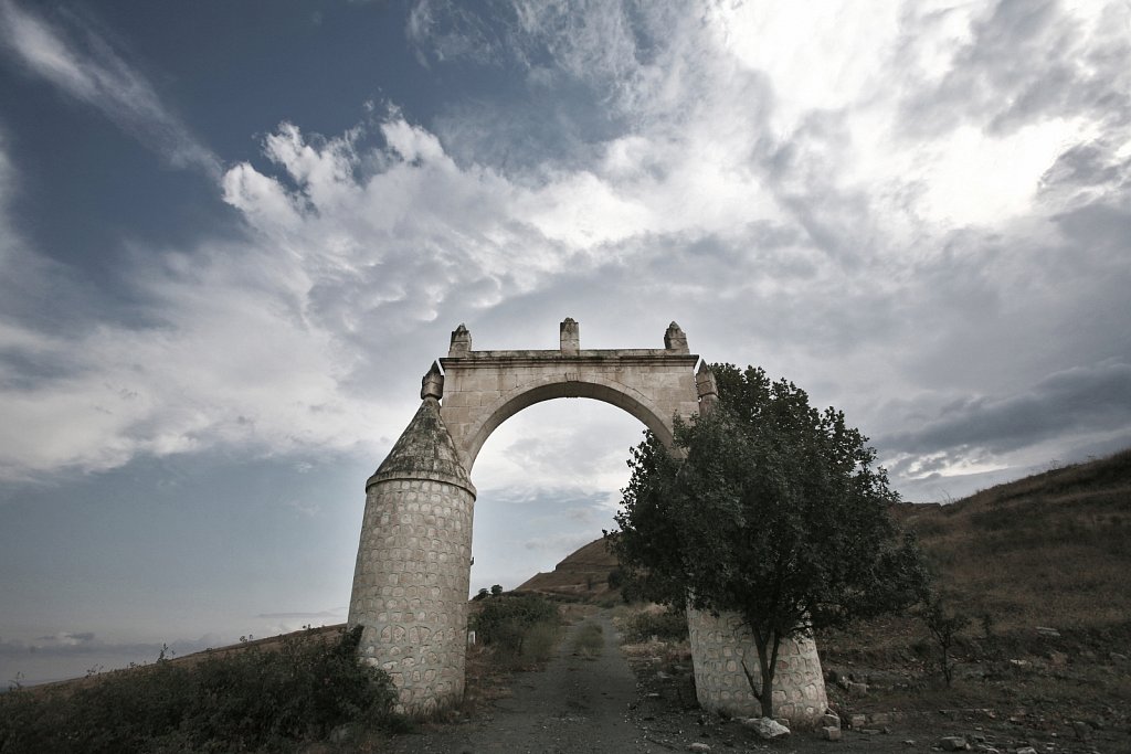
The gate of Vanqasar church (VIIth century) near Tigranakert of Artsakh. According to historians there were 5 major cities built by Tigran the Great at various strategic positions throughout the Armenian Empire. Each of these cities was named after the king - Tigranakert. This one, named Tigranakert of Artsakh, occupies an area of about 50 hectares and is located in the province of Martakert in the Nagorno-Karabakh, four kilometers South of the Khachenaget River. Excavations at Tigranakert began in March 2005, when it was first discovered, and are currently ongoing. Aghdam region, Nagorno-Karabakh, 19 September 2008.
Nagorno-Karabakh
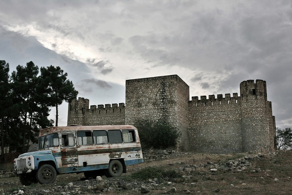
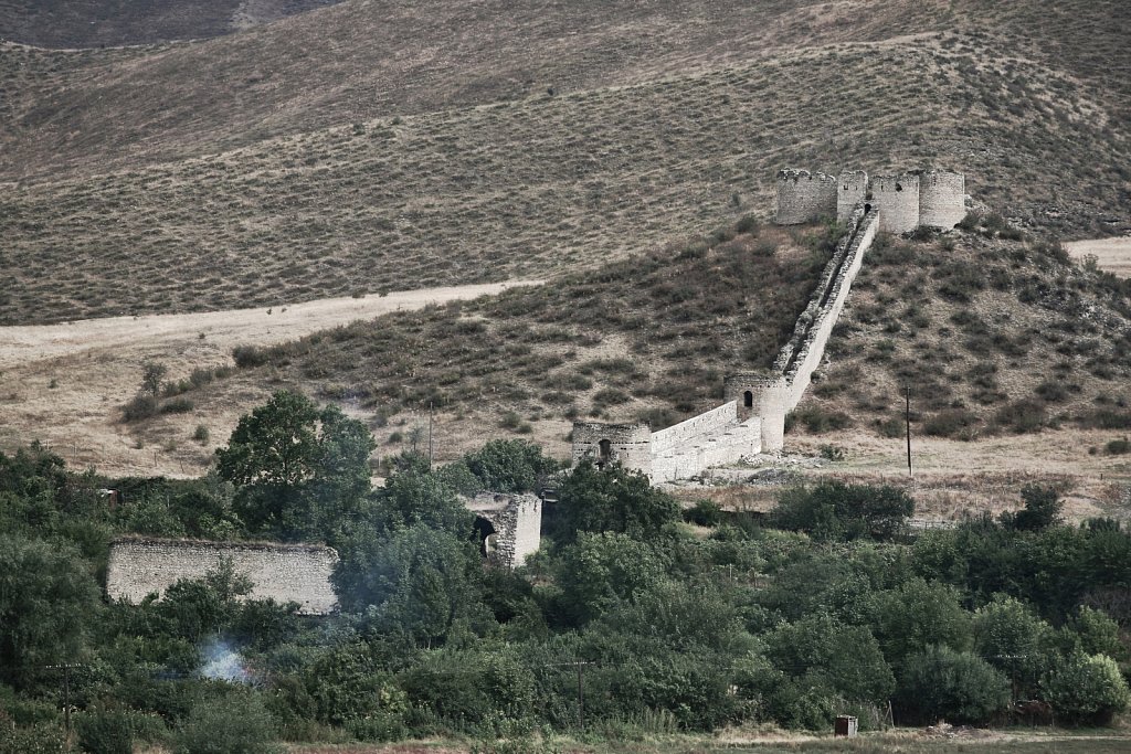
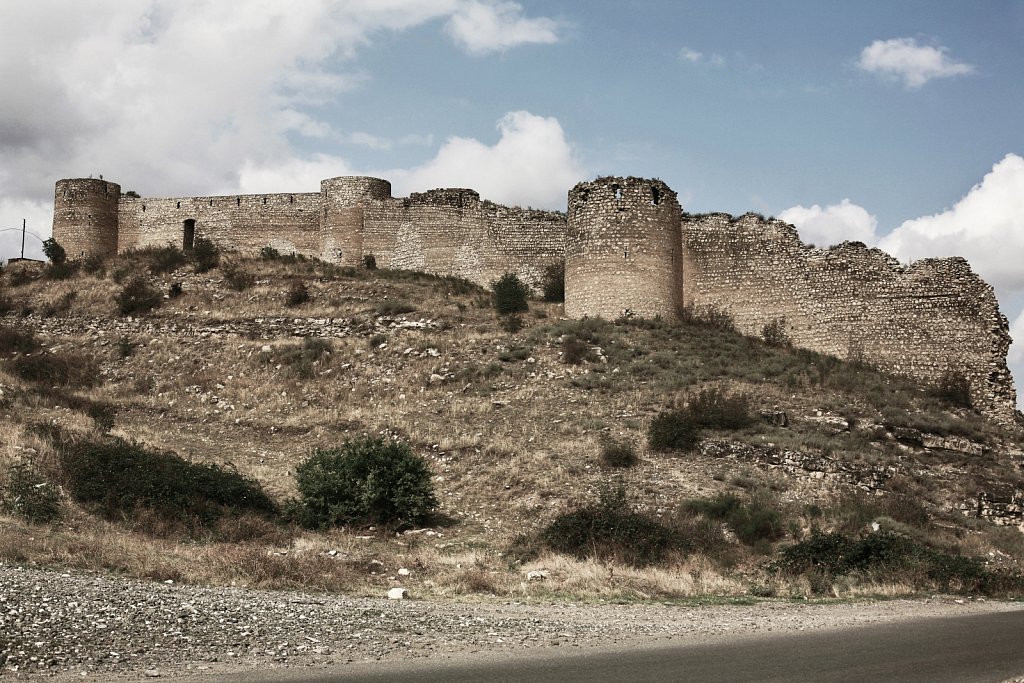
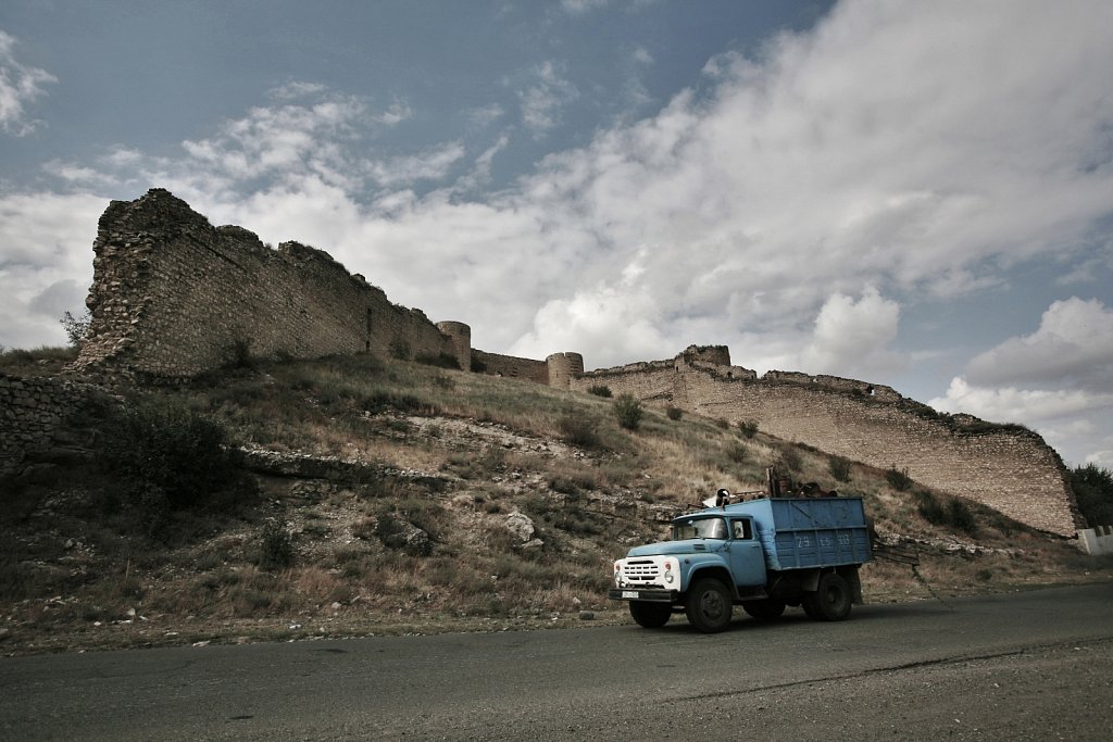
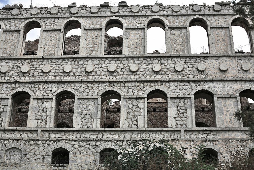
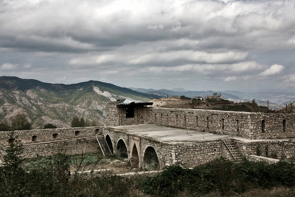
Mayraberd Askeran Fortress (built 1751) is situated in the town of Askeran, 14 km East from Stepanakert, the capital of Nagorno-Karabakh. It is located on the banks of the Qarqar River and was built by the Karabakh khanate ruler Panah Ali Khan and consists of two sections. The left-bank section features a double line of stone walls - 2m thick and 9m tall. The walls of this vanguard fort of Karkar valley stretch over 1.5km and during the Nagorno-Karabakh War, the fortress served as the military headquarters for Nagorno-Karabakh Armenians fighting against Azerbaijan. Askeran, Nagorno-Karabakh, 19 September 2008.
Nagorno-Karabakh
Mayraberd Askeran Fortress (built in 1751) is situated in the town of Askeran, 14 km East from Stepanakert, the capital of Nagorno-Karabakh. It is located on the banks of the Qarqar River and was built by the Karabakh khanate ruler Panah Ali Khan and consists of two sections. The left-bank section features a double line of stone walls - 2m thick and 9m tall. The walls of this vanguard fort of Karkar valley stretch over 1.5km and during the Nagorno-Karabakh War, the fortress served as the military headquarters for Nagorno-Karabakh Armenians fighting against Azerbaijan. Askeran, Nagorno-Karabakh, 19 September 2008.
Nagorno-Karabakh
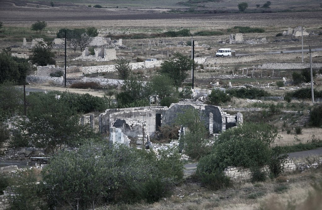
The ruins of Aghdam, city at the borderline between Nagorno-Karabakh and Azerbaijan has been totally destroyed during the armed conflict and afterwards. It is now a ghost-city, who once had it's own airport and a population of 160.000. Being on the borderline, there are still fights going on in this area which is considered a buffer zone between the two countries. The place is also known to be dangerous for it's unexploted mines. There is no official report of mines left unexploded, but it is certain that Nagorno-Karabakh is one of the former Soviet Union territories with the greatest area of minefields. Aghdam, Nagorno-Karabakh, 19 September 2008.
Nagorno-Karabakh
The ruins of Aghdam, city at the borderline between Nagorno-Karabakh and Azerbaijan has been totally destroyed during the armed conflict and afterwards. It is now a ghost-city, who once had it's own airport and a population of 160.000. Being on the borderline, there are still fights going on in this area which is considered a buffer zone between the two countries. The place is also known to be dangerous for it's unexploted mines. There is no official report of mines left unexploded, but it is certain that Nagorno-Karabakh is one of the former Soviet Union territories with the greatest area of minefields. Aghdam, Nagorno-Karabakh, 19 September 2008.

Nagorno-Karabakh
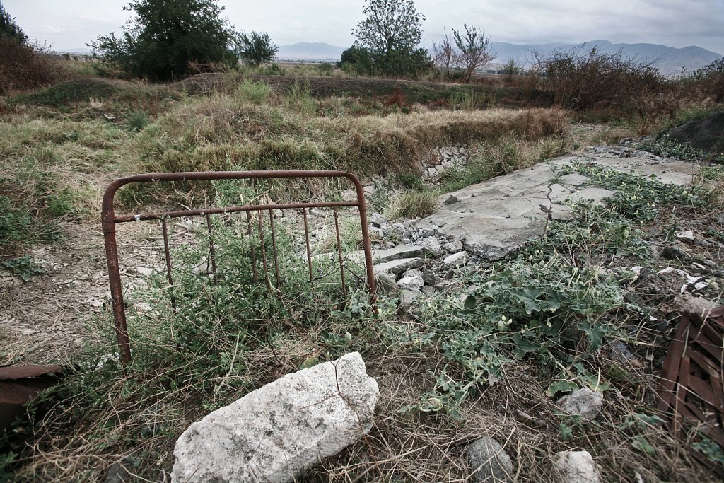
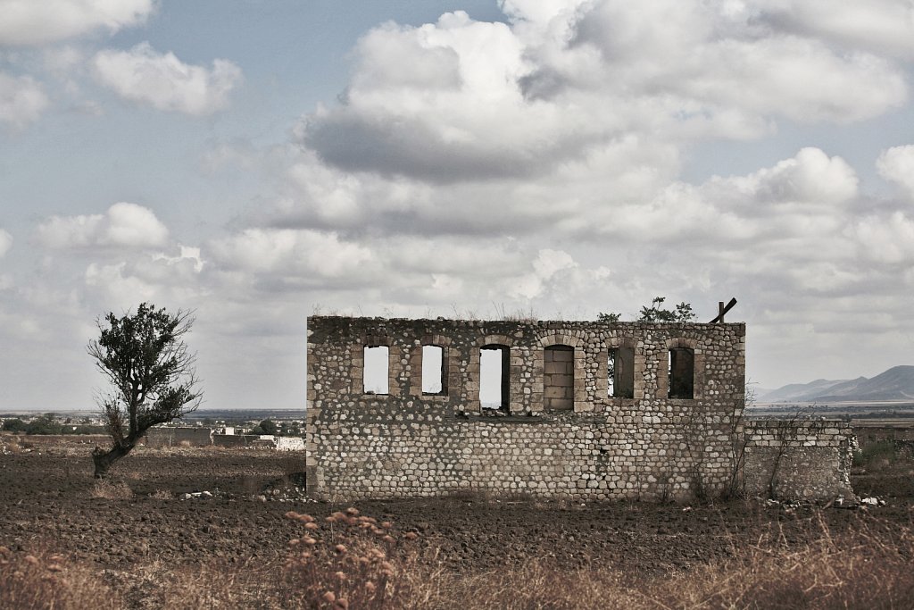
A piece of wall remained intact on a field near Khojaly city, Nagorno-Karabakh. Khojaly is a military base, situated near the border with Azerbaijan and 10 km Northeast of the capital Stepanakert. The city is known for the Khojaly Massacre committed on 25–26 February 1992 by the Armenian and, partially, by CIS armed forces (the Russian 366th Motor Rifle Regiment) during the Nagorno-Karabakh War. There is no official report of mines left unexploded, but is certain that Nagorno-Karabakh is one of the former Soviet Union territories with the greatest area of minefields. Khojaly, Nagorno-Karabakh, 19 September 2008.
Nagorno-Karabakh
A wall of the Natavan Castle (XIXth century) in the city of Shushi. Natavan Castle was named after the Azerbaidjani poetess Khan Gizi Hurshid Banu Natavan (1830-1897). Before the Nagorno-Karabakh War the city was the main cultural center of Karabakh, also known as “Paris of the Caucasus”. With more than three quarters of the buildings being destroyed during the war, the city has begun the reconstruction of historical buildings with a special architectural and historical value. Shushi, Nagorno-Karabakh, 18 September 2008.
Nagorno-Karabakh
A fragment of the Natavan Castle wall (XIXth century) in the city of Shushi. Natavan Castle was named after the Azerbaidjani poetess Khan Gizi Hurshid Banu Natavan (1830-1897). Before the Nagorno-Karabakh War the city was the main cultural center of Karabakh, also known as “Paris of the Caucasus”. With more than three quarters of the buildings being destroyed during the war, the city has begun the reconstruction of historical buildings with a special architectural and historical value. Shushi, Nagorno-Karabakh, 18 September 2008.

Nagorno-Karabakh
A partly restored Shia Mosque in the town of Shushi. Before the Nagorno-Karabakh War the city was the main cultural center of Karabakh, also known as “Paris of the Caucasus”. With more than three quarters of the buildings being destroyed during the war, the city has begun the reconstruction of historical buildings with a special architectural and historical value. Shushi, Nagorno-Karabakh, 20 September 2008.
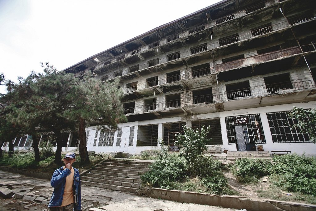
Nagorno-Karabakh
A boy walks in front of a ruined communist apartment block in the city of Shushi. The city is considered the second largest in Nagorno-Karabakh after the capital of Stepanakert, as size and population density. Before the Nagorno-Karabakh War it was the main cultural center. Shushi, Nagorno-Karabakh, 18 September 2008.